Log in
All resources
Create a design
4,774 Free Images of Atlas Map
gemeente atlas van nederland - south holland
1860s maps of south holland
joan blaeu
copper engraving print
british library
atlas novus (blaeu)
atlas van loon
miniature speed atlas (1627) pieter van den keere
pieter van den keere
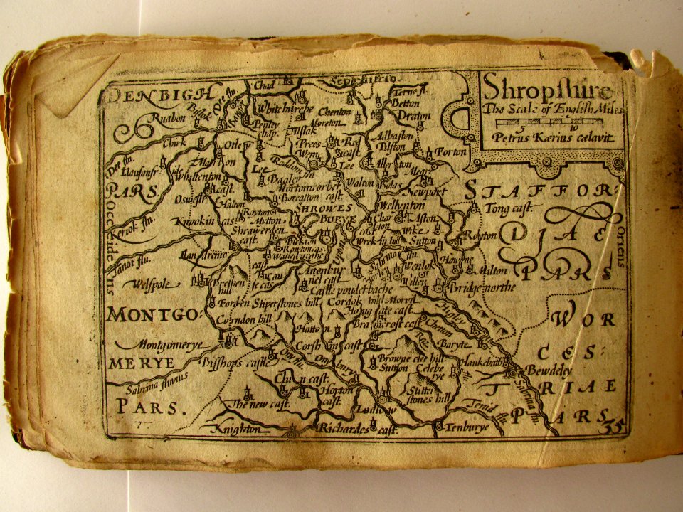
county maps of england by john speed
maps made in the 17th century
forts in the netherlands
siege of lingen 1597
maps of lingen (ems)
historisk atlas (stockholm, norstedt & söner, 1880)
old maps of the polish-lithuanian commonwealth
maps by willem and johannes blaeu
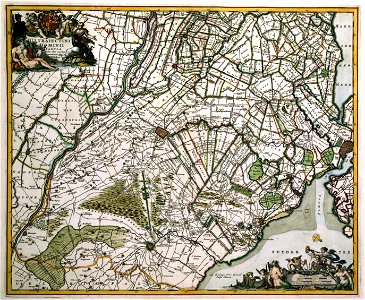
17th-century maps of europe
counties of england in art
1590 engravings
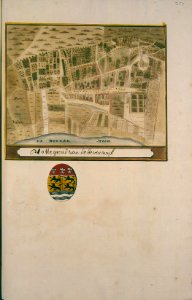
gemeente atlas van nederland - south holland
19th-century maps of rotterdam
gemeente atlas van nederland - north holland
old maps of beverwijk
gemeente atlas van nederland - south holland
maps of hellevoetsluis
19th-century maps of south holland
maps of veur
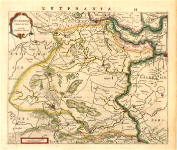
gemeente atlas van nederland - gelderland
netherlands in the 1860s
details of old maps of india
atlas minor
maps of lappland
1662
old maps of westerwolde
maps of vlagtwedde
gemeente atlas van nederland - north holland
19th-century maps of amsterdam
atlas maior, vol 10 (spain and africa) - joan blaeu, 1667 - bl 114.h(star).10
1667 maps
gemeente atlas van nederland - south holland
maps of loosduinen
maps of werkendam
maps of dussen
atlas maior, vol 1 (northern europe, norway, and denmark) - joan blaeu, 1667 - bl 114.h(star).1
17th-century maps of iceland
atlas maior, vol 5 (england) - joan blaeu, 1667 - bl 114.h(star).5
17th-century maps of yorkshire
atlas maior, vol 2 (sweden, russia, poland, eastern europe, and greece) - joan blaeu, 1667 - bl 114.h(star).2
17th-century maps of prussia
atlas maior, vol 2 (sweden, russia, poland, eastern europe, and greece) - joan blaeu, 1667 - bl 114.h(star).2
17th-century maps of scandinavia
atlas maior, vol 2 (sweden, russia, poland, eastern europe, and greece) - joan blaeu, 1667 - bl 114.h(star).2
old maps of macedonia
atlas maior, vol 5 (england) - joan blaeu, 1667 - bl 114.h(star).5
17th-century maps of yorkshire
atlas maior, vol 5 (england) - joan blaeu, 1667 - bl 114.h(star).5
17th-century maps of yorkshire
atlas maior, vol 7 (france i) - joan blaeu, 1667 - bl 114.h(star).7
1667 maps
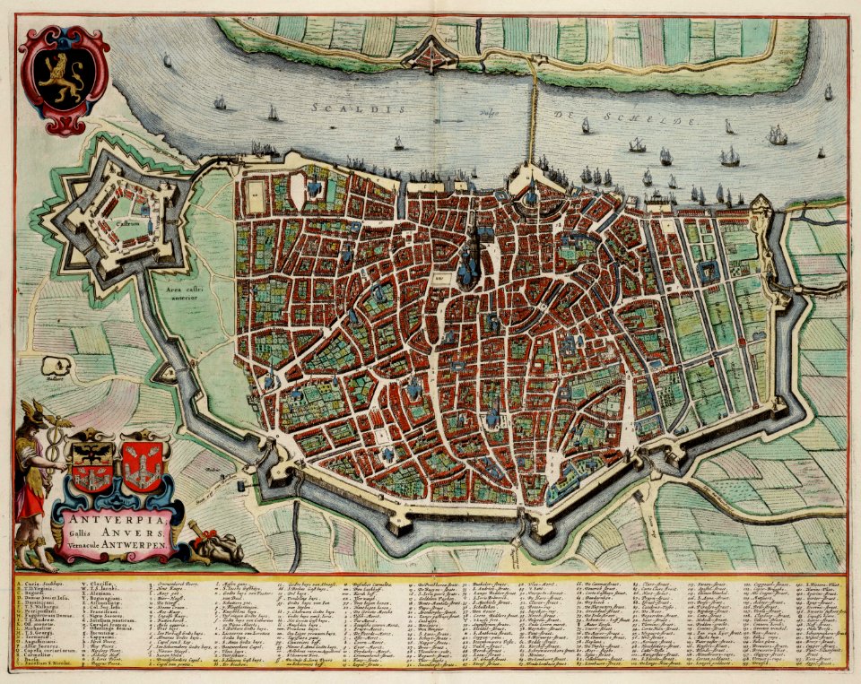
johannes blaeu - map of antwerp
atlas van loon
miniature speed atlas (1627) pieter van den keere
county maps of england by john speed
coats of arms of the kingdom of navarre
coats of arms of the crown of aragon
old maps of groningen (province)
maps by christian sgrothen
gemeente atlas van nederland - north holland
maps of haarlemmermeer
gemeente atlas van nederland - south holland
old maps of gorinchem
gemeente atlas van nederland - south holland
old maps of dordrecht
gemeente atlas van nederland - south holland
maps of maassluis
maps of upper palatinate
old maps of bavaria
atlas schoemaker-noord-holland, amsterdam
buikslotermeer
maps of tournai city walls
old maps of tournai
old maps of zwolle
atlas van loon
gemeente atlas van nederland - south holland
1860s maps of south holland
gemeente atlas van nederland - south holland
1860s maps of south holland
gemeente atlas van nederland - south holland
19th-century maps of rotterdam
old maps of friuli-venezia giulia
maps of carniola
old maps of gelderland
old maps of zutphen
old maps of westphalia
sharp s
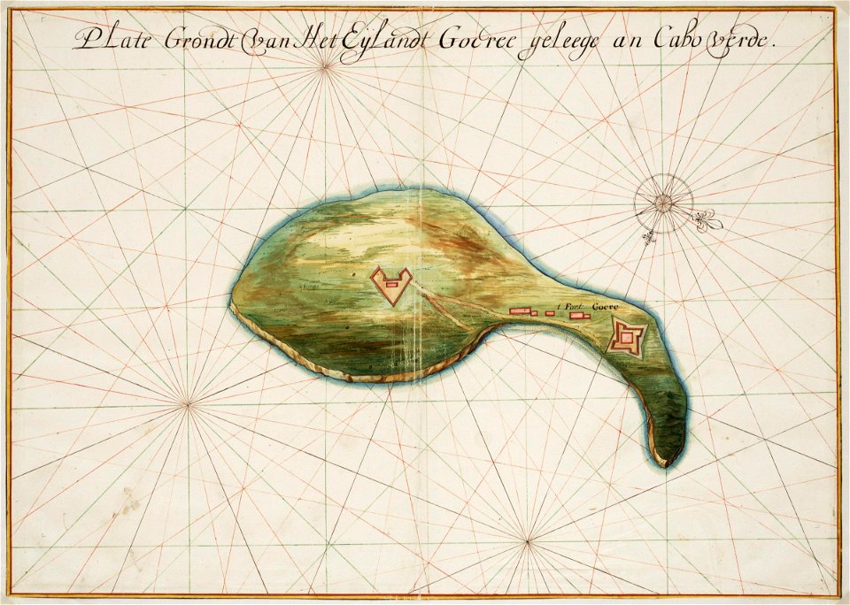
maps of the west-indische compagnie
1665
maps of the dutch east india company - india
dutch suratte
atlas van loon
maps of sieges
russian empire in thomas kitchen's general atlas (1773)
general atlas (1773)
locator maps of the harbour of rotterdam
glashaven (canal in rotterdam)
atlas schoemaker-noord-holland
old maps of beverwijk
maps of hooge zwaluwe
maps of lage zwaluwe
maps of oudenaarde city walls
old maps of oudenaarde
gemeente atlas van nederland - south holland
maps of maasdam
1640s maps of the netherlands
coats of arms on maps
gemeente atlas van nederland - south holland
1860s maps of south holland
miniature speed atlas (1627) pieter van den keere
maps of wales by john speed
gemeente atlas van nederland - south holland
1860s maps of south holland
alphonsus lasor a varea
maps by jodocus hondius
17th-century maps of southeast asia
maps by jodocus hondius
vesting bourtange
atlas van loon
gemeente atlas van nederland - north holland
19th-century maps of den helder
maps by willem and johannes blaeu
maps of the duchy of limburg
gemeente atlas van nederland - south holland
1860s maps of south holland
maps from university of amsterdam special collections
atlas der neederlanden
1660s maps of spain
1667 maps
maps of paris from the barry lawrence ruderman antique maps inc.
key sheet of the turgot map of paris
atlas maior, vol 5 (england) - joan blaeu, 1667 - bl 114.h(star).5
old maps of anglo-saxon england
atlas maior, vol 2 (sweden, russia, poland, eastern europe, and greece) - joan blaeu, 1667 - bl 114.h(star).2
17th-century maps of finland
atlas maior, vol 5 (england) - joan blaeu, 1667 - bl 114.h(star).5
17th-century maps of norfolk, england
atlas maior, vol 12 (america) - joan blaeu, 1667 - bl 114.h(star).12
1667 maps
atlas sive cosmographicae (gerardus mercator, 1596)
16th-century maps of colombia
history of tienen
atlas van loon
old maps of namur (province)
coats of arms on maps
atlas maior, vol 6 (scotland and ireland) - joan blaeu, 1667 - bl 114.h(star).6
1667 maps
gemeente atlas van nederland - south holland
old maps of vlaardingen
gemeente atlas van nederland - south holland
1860s maps of south holland
gemeente atlas van nederland - south holland
1860s maps of south holland
gemeente atlas van nederland - south holland
1860s maps of south holland
gemeente atlas van nederland - south holland
1860s maps of south holland
maps of the republic of venice
17th-century maps of istria
atlas des anciens plans de paris by imprimerie nationale, 1880 from the musée carnavalet
maps of paris from paris musées
gemeente atlas van nederland - south holland
1860s maps of south holland
gemeente atlas van nederland - south holland
1860s maps of south holland
miniature speed atlas (1627) pieter van den keere
county maps of england by john speed
miniature speed atlas (1627) pieter van den keere
maps of wales by john speed
miniature speed atlas (1627) pieter van den keere
county maps of england by john speed
miniature speed atlas (1627) pieter van den keere
county maps of england by john speed
miniature speed atlas (1627) pieter van den keere
county maps of england by john speed
miniature speed atlas (1627) pieter van den keere
county maps of england by john speed
miniature speed atlas (1627) pieter van den keere
county maps of england by john speed
coats of arms on maps
atlas maior
grosser deutscher atlas
1790s maps of ireland
locator maps of the harbour of rotterdam
zalmhaven (rotterdam)
atlas van der hagen (volume 2)
atlas van der hagen
old maps of veliky novgorod
maps of velikiy novgorod
ancienne église saint-hippolyte de paris
churches on turgot map of paris
maps by john cary
1799 maps
old maps of lake constance
old maps of swabia
17th-century maps of herefordshire
1646 maps
atlas van der hagen (volume 3)
atlas van der hagen
1640s maps of the tsardom of russia
sigismund's map of moscow
701 - 800 of 4,774
Next page
/ 48